

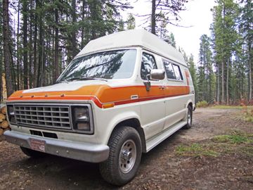








The wooden lookout on the Midnight Dome shows the whole Klondike: Dawson City against the Yukon River, the valley behind it, and the Ogilvie Mountains on the horizon. Dome Road is the drive up to that rocky bluff. The night is the Yukon River Territorial Campground, on the far bank from town.
You cross on the George Black Ferry and spend the night facing the same river the Dome looks down on. The van stays on that bank, and you ferry back for Dawson City, the Klondike gold-rush town on this side of the river. Around the Dawson City Music Festival in late July the campground fills with festival traffic, so an ordinary June or August night on that bank is the easier one to land.
South of Dawson City the Dempster Highway starts as a two-lane, all-weather gravel road on a permafrost berm. Tombstone Territorial Park is the mountain park at the beginning of that drive.
The interpretive centre and the campground are next to each other, about an hour and a half up the gravel from Dawson City. The park requires a permit for any overnight, and the next fuel is Eagle Plains, far to the north. Once you leave town, services thin out fast.
Dawson City calls the Dempster the only road in Canada that crosses the Arctic Circle. Past Tombstone the gravel keeps going, and the far end is Inuvik in the Northwest Territories.
If you need more sleeping space than a campervan for a week of Dempster nights, look at RVs for rent in the Yukon.
The Alaska Highway through Watson Lake
The Alaska Highway's Yukon stretch is its own campervan week, with Watson Lake as the night that has a stop attached. From there the road continues toward Whitehorse or toward Dawson City.
Watson Lake's Sign Post Forest is posts stacked with hand-lettered plates and license plates. Travel Yukon puts the collection at almost 100,000 signs. A soldier working on the highway put up the first one in 1942, and the town has kept adding to it since.
The night that matches the stop is Watson Lake Campground on the south shore of the lake, first-come with no reservable sites. You sleep on the water after a day on the highway. Big Creek Campground is up the road, first-come by self-registration.
Kluane, Miles Canyon, and Carcross are the Whitehorse trip. South of Watson Lake the same highway continues into British Columbia.
The Top of the World Highway out of Dawson City
West of Dawson City the Top of the World Highway is a narrow gravel road above the treeline. From the van the Yukon River and the Ogilvie Mountains stay in view along the ridge.
You start it from the same George Black Ferry that serves the river campground, then follow the ridge west to the Little Gold Creek crossing. The crossing is seasonal and closes for winter, as of September 2026. Alaska is on the other side of that crossing.